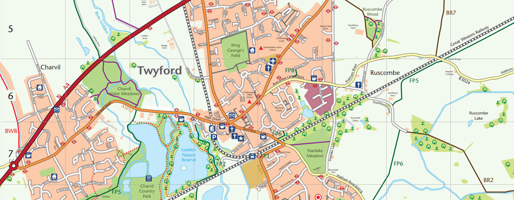
Shows the maze of paths and alleyways within the village which can be used as peaceful short-cuts. See map
This walk takes you through Stanlake Park and Broad Hinton (2 miles or 4 miles). See map
This map guides you past the former silk and flour mills before exploring the Loddon Valley (3 miles). See map
This walk reveals the lakes and woodlands reclaimed from old gravel workings and now havens for wildlife (3.5 miles). See map
The walking maps were produced by former Twyford Together volunteer, Sue Goddard with the help of Twyford and Ruscombe Local History Society and James Turner from Hidden Britain,
Get Twyford Walking was first published in 2010 thanks to a grant from the South East England Development Agency (SEEDA). It proved so popular that all 6,000 copies were snapped up by local walkers. Consequently, a fully revised 2nd edition of the map was printed in 2013. This was made possible by a grant from The Co-operative Membership Community Fund, supplemented by some remaining regional Government money and contributions from local Twyford businesses. Ruscombe, Church, The River Loddon and Charvil Country Park were produced in 2012. There are no plans currently to print any further copies.
“I just want as many people as possible to be able to appreciate the wealth of natural beauty and history we have close to the village”.
Sue Goddard, Twyford Together Volunteer